
@ 2012 Land And Water Resources, Inc. All rights reserved. Website by RME.
A national leader since 1994 in creating, building and managing wetland mitigation banks.

Helpful Links
Ferson Creek Wetland Mitigation Bank
82.25 acres restored, 76.03 mitigation credits
Wetland Banker:
Land and Water Resources, Inc. (LAWR)
Land Owner:
Kane County Development Corporation
Jerry Boose
320 Realingned La Fox Road
Saint Charles, IL 60175
(630) 584-0042
Long Term Land Owner and Manager:
Kane County Forest Preserve District
USACOE Permit 199600027
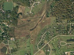
Aerial Photo
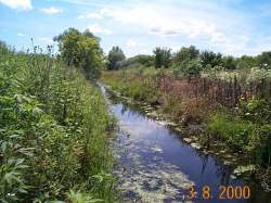
Ferson Creek
LAWR teamed up with Kane County Development Corporation to develop a 92 acre site containing wetland mitigation bank and upland prairie in St. Charles, Kane County, Illinois. LAWR was responsible for all aspects of the bank from conception, permitting, development, financing, construction, operation, and sales. Kane County Development Corporation provided the land.
The site, prior to permitting was a 92 acre farm field primarily within the floodplain of Ferson Creek, a tributary to the Fox River. The field was extensively tiled and several small farmed wetland pockets existed on the site. This stretch of Ferson Creek had been straightened to allow for farming activities. The project re-established the original meanders in the creek and filled in the existing channel. Additional areas were graded to lower the ground to the proper elevation for wetland creation.
The landowner utilized the upland adjacent to the project to construct a residential subdivision. LAWR was able to create and sell 75.83 acres of wetland mitigation credit to offset 49.15 acres of wetland impact. The landowner is transferring the land to the Kane County Forest Preserve District, which is obtaining a 92 acre natural area at no cost to the taxpayers.
Management activities at the site included aggressive herbiciding of invasive species, mowing and burning. Two years into the project additional grading occurred on a small (6 acre) part of the bank because that area was not meeting hydrology.
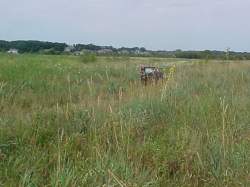
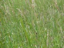
Even though the primary challenge at the site is the control of non-native reed canary grass, which is brought to the site through flooding of Ferson Creek, over 186 plant species have been identified at the site. Of these 74.2% are native species. The site has achieved moderate to high quality natural area status as defined by Swink and Wilhelm (1994). This bank has received final sign off from the regulatory agencies.
SOLD OUT!